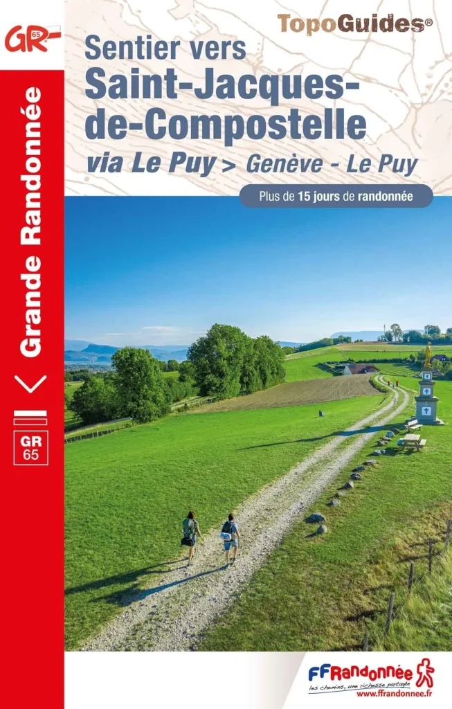
The famous path of Saint-Jacques GR®65 from Puy-en-Velay actually begins in Geneva! It connects the “Via Gebennensis” between Geneva and Le Puy-en-Velay and the “Via Podiensis” between Le Puy-en-Velay and Saint-Jean-Pied-de-Port.
La way of Geneva of the path of Saint-Jacques-de-Compostelle is the link with Switzerland, Eastern Europe and the roads of southern Germany. It is a route that runs along the Rhone over many kilometers and punctuates the mountainous environments between the Alpes, the The Massif Central and the great plains of the Rhône valley. It is rich in its heritage, the variety of its landscapes and its terroir with the vine and its great appellations on the side of Condrieu et Chavanay. From the shores of Lake Geneva, reach Le Puy-en-Velay, the historic start of the path of Saint-Jacques in the footsteps of ancient pilgrims.
TECHNICAL SHEET
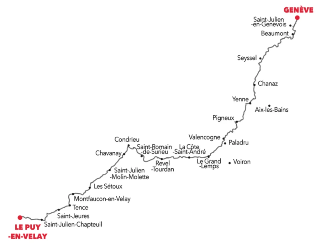
GR®65 SAINT-JACQUES: FROM GENEVA TO PUY EN VELAY
- Departure: Geneva
- Arrival: Le Puy-en-Velay
- Distance: 360km
- Duration: 18 days
- Means of transport for departure: airport/train in Geneva
- Means of transport for the return: SNCF station in Puy-en-Velay
- Website : https://cheminsdesaint-jacques.com/
Stage 1: From Geneva to Beaumont
The Geneva Way of the Chemin de Saint-Jacques begins on the square in front of the Saint-Pierre Cathedral in Geneva. The remarkable building was included in July 2009 in the list of honor “ of European heritage » because of its important historical-cultural value for European history. This label certifies monuments that are emblematic of European values and relations between peoples. A beautiful symbol for a departure towards Compostela whoseThe paths are 1er registered on the European Cultural Routes by the Council of Europe in 1987.
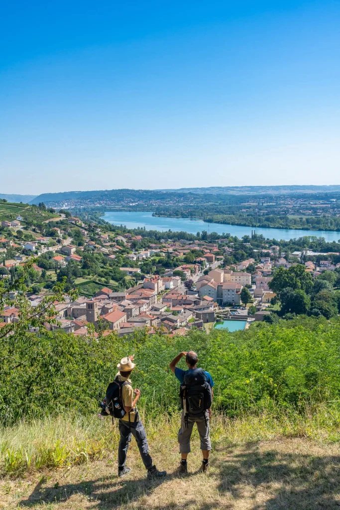
Then the GR® 65, starting from Geneva, quickly joins the Rhône River . The latter will follow the hikers for two-thirds of the route: from Lyon to the entrance into the Massif Central, around Condrieu.
Leaving the city and arriving in the Swiss countryside, you pass through the hamlet of Compensières where it is possible to discover the Compensières commandery , a fortified house that belonged to the Order of the Hospitallers of Saint John of Jerusalem.
Step 2: From Beaumont to Chaumont
This second, rather long, stage of the Geneva route takes hikers from Beaumont to Chaumont , crossing the countryside of the Haute-Savoie region of Geneva . This path between Salève and Vuache offers magnificent views of the Geneva basin and the Alps.
Several points of interest and heritage sites mark this stage: the Pomier Charterhouse , Santa Claus Village at the Col du Mont-Sion, and the Chaumont Castle in the Usses Valley.
Step 3: From Chaumont to Seyssel
Today's stage is divided into two beautiful sections. The first allows you to discover the Usses Valley , a river that the pilgrim will cross at Frangy , before tackling a second, considerably more challenging section of the route. This hike through the hills offers a rolling landscape before reaching the heights of Seyssel , where the guesthouses are located.
Step 4: From Seyssel to Chanaz
A downhill stage, then without any major difficulties, allows you to start from the heights of Seyssel and reach the very pretty village of Chanaz, which welcomes 200,000 visitors each summer. While the entire first part of the stage leads to the confluence of the Fier and Rhône rivers , the entire second part takes place in the Rhône basin, where the human impact on the landscape is very evident through housing, agriculture, and industry.
Chanaz , located at the confluence of the Savières Canal and the Rhône River, is nicknamed "the little Venice of Savoy ." Walkers can enjoy its narrow 15th and 16th-century streets, the houses with limestone facades and flat tile roofs, the Boigne house and its dovecote, the bread oven, the walnut and hazelnut oil mill, the Gallo-Roman museum "Les Potiers de Portout" in the Gothic chapel "Notre Dame de Miséricorde," the lock, the leisure center…
Step 5: From Chanaz to Yenne
Today's stage takes place entirely within the Savoie department, between Chanaz and Yenne. The GR® trail largely follows the Rhône River, which hikers leave at the start to gain altitude, only to rejoin it upon arrival in the medieval village of Yenne . The vineyards of Savoie characterize the landscapes traversed by hikers, as well as the nearby hills, notably the Dent du Chat , visible to the southeast from the stage's panoramic viewpoint.
Stage 6: From Yenne to Saint-Genix-sur-Guiers
The 6th day of the Geneva route of the Chemin de Saint-Jacques is a sporting stage! From Yenne and the banks of the Rhône, the path takes you to Saint-Genix-sur-Guiers having to cross the Mont Tourbier, culminating at 880 meters above sea level.
The first part of the stage is dedicated to climbing a wooded path along the mountainside before descending to the banks of the Guiers River . From a heritage perspective, the Notre-Dame de la Montagne chapel , a nod to the Basilica of Fourvière in Lyon, is well worth a visit. Upon arrival, a brioche with pralines from Saint-Genix rewards the day's efforts!
Stage 7: From Saint-Genix-sur-Guiers to Valencogne
Departing from Savoie, this is the first of many stages which will allow you to cross the department of'Isère. After the mountains of Savoie, the path Saint-Jacques enters Isère via the communes of Aoste, Romagnieu, Les Abrets en Dauphiné, Saint Ondras and Valencogne for a gentle stopover on the hills of the Vals du Dauphiné.
The path, between countryside and villages, crosses part of the Dauphiné and heads south to reach, from the next stage, the heights of Lake Paladru and begin the turn due west which will lead travelers towards the Massif Central.
Stage 8: From Valencogne to Grand Lemps
The stage from Valencogne to Grand-Lemps is quite challenging but offers the chance to discover beautiful forest areas and Lake Paladru . As for heritage, among the hamlets and villages along the 20 kilometers of the day, the former monastery of the Chartreuse de la Sylve Bénite and especially its tithe barn are well worth a visit.
Stage 9: From Grand Lemps to La Côte Saint André
This fairly short stage, 100% in Isère, leads the hiker to La Côte-Saint-André , the birthplace of the famous 19th-century French composer Hector Berlioz.
Along the way, you will enjoy the small country roads and several private castles (Montgontier and Pointières and Louis XI) which line the route.
Shortly before arrival, a short out-and-back trip to climb to the promontory of the Notre-Dame-du-Mont chapel is worth the detour for the exceptional panorama offered over the Alps and the Plaine de la Bièvre.
Stage 10: From Côte Saint André to Revel-Tourdan
From La Côte Saint Andrée, it's time to continue west to the Saint Michel de Balbin chapel. Erected in 1525 by Pierre de Salignon, lord of La Buissonnière, this chapel dedicated to the Archangel Saint Michael offers a superb panoramic view of the surrounding area.
The GR® trail continues through the Isère countryside, crossing fields and small forests dotted with several streams and ponds, such as the Étang du Marais near Faramans. Numerous crosses mark the path. After the village, you cross Pommiers Beaurepaire and then pass slightly north of the Château de Barbarin before arriving in the heart of the village of Revel, in the commune of Revel-Tourdan.
This part of the village is perched on the hill and dominates the plain of Tourdan and Bièvre-Valloire. The Croton site where the ruins of the old castle sit offers a wide panorama of the Alps, the Vercors and the Rhône valley.
Stage 11: From Revel-Tourdan to Saint-Romain-de-Surieu
This 20-kilometer stage allows hikers to continue their journey through the Isère countryside . Between small country roads and wooded paths, the route offers lovely open landscapes with the Massif Central and the Alps in the background. As for heritage sites, the Chapel of La Salette , the Surieu Monastery , and the crossing of the high-speed rail line between Paris, Lyon, and Marseille punctuate the route.
Stage 12: From Saint-Romain-de-Surieu to Chavanay
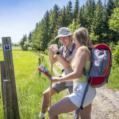
After Saint-Romain-de-Surieu, the path leads to Chavanay and the banks of the Rhône . The last stage before the Massif Central , the route offers several variations between the GR (long-distance hiking trail) and paths marked by pilgrim associations. To avoid getting lost, it is recommended to follow the white and red markings of the long-distance hiking trails.
Food lovers will definitely make a stop in Condrieu to taste two appellations of origin: Condrieu (white wine) and Rigotte de Condrieu (goat cheese).
Stage 13: From Chavanay to St-Julien-Molin-Molette
This stage, the first in the Massif Central , is entirely within the Pilat Regional Natural Park . It is also here that you begin the climb towards the Haute-Loire . Near Bessey , you can admire the panoramic views of the nearby Pilat peaks , including the Crêt de l'Oeillon (1370m) and the rocky landscape of the Trois-Dents (1211m). Then, at the Sainte-Blandine cross , a quick turn allows you to appreciate your ascent while admiring the Rhône Valley, the Alps, and the Ardèche department.
Stage 14: From St-Julien-Molin-Molette to Sétoux
The section of the Geneva Way between Saint-Julien-Molin-Molette and Bourg-Argental is not the easiest, but it brings great satisfaction at the end of the day. Indeed, in the heart of the Pilat massif, the path leads to the watershed between the Atlantic and the Mediterranean, the tipping point between the last foothills of the Rhône valley and the volcanic plateaus of Velay: the Col du Tracol.
To do this, the GR © first follows the Via Fluvia , the greenway between the Loire and Rhône rivers, then forest paths to the pass. After crossing the Pilat and Vivarais regions, the Velay region now accompanies the hiker for the last part of the journey.
Stage 15: From Sétoux to Montfaucon-en-Velay
The initial stretch, just under 20 kilometers, to Montfaucon-en-Velay , is a celebration of nature, both in its atmosphere and its landscapes. It also offers the opportunity to admire, in the distance, the rooftops of the Haute-Loire region , with Mont Mézenc , Mont Alambre , Pic du Lizieux , and the Meygal massif . In the village, it would be a shame to miss the collection of 12 16th-century Flemish paintings by Abel Grimmer, on permanent display in the Notre-Dame chapel.
Stage 16: From Montfaucon-en-Velay to Saint Jeures
To reach Tence and then Saint-Jeures, you partially follow the Velay Express route . For a change of pace, it's also possible to reach Raucoules station and then continue to Tence via this route, if the season and timetable allow. Along the way, the landscapes and architecture begin to change, and you'll see the first stone houses with slate roofs.
Stage 17: From St-Jeures to St-Julien-Chapteuil
A 100% Meygal stage awaits you in the heart of the volcanic peaks of Haute-Loire ! The path gradually leads to over 1000m altitude where you will cross emblematic sites such as the villages of Araules , Monedeyres and Saint-Julien-Chapteuil but also superb panoramas on the Testavoyre or the Queyrières rock composed of basalt organs, witness to the surrounding volcanism.
Stage 18: From St-Julien-Chapteuil to Puy-en-Velay
La last step of the way of Geneva of the way of Saint-Jacques allows you to reach Le Puy-en-Velay from Saint-Julien-Chapteuil. This end of the route will be done slowly downhill.
This arrival at Puy-en-Velay on the way to Saint-Jacques is a outcome for some or a call for others towards a new beginning always on the GR®65 but this time continuing on the “Via Podiensis”. The walkers are then left with nearly 1550 km before arrival at Saint-Jacques-de-Compostelle from Puy-en-Velay.
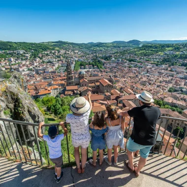
At the end of your trip, take the time to visit the city of Le Puy-en-Velay and its iconic monuments: the Puy Cathedral , a UNESCO World Heritage Site; the statue of the Virgin Mary offering a 360-degree view of the city; and the Saint-Michel d'Aiguilhe rock and its chapel. It's hard to leave Le Puy-en-Velay without having tasted a dish of Puy green lentils (AOP) and the traditional Velay green verbena , after tucking a piece of Puy lace into your bag as a souvenir!
Book your stay
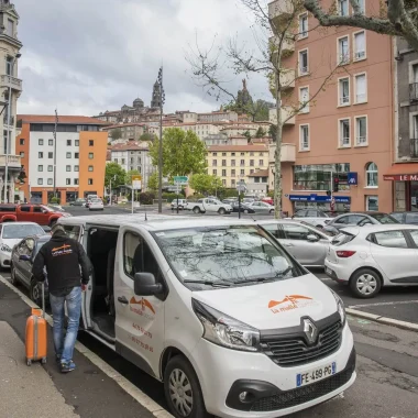
You want to do the Way of Saint-Jacques without worrying about the logistical details? Then go with one of our partner travel agencies. They will be able to guide you in order to have a pleasant stay from Geneva or Condrieu towards Le Puy-en-Velay on the way to Saint-Jacques-of Compostela.


GPX TRACK
PRACTICAL TIPS
FAQ
What are the recommended stages of the Geneva route of the Chemin de Saint-Jacques GR®65?
1) Geneva > Beaumont: 16 km
2) Beaumont > Chaumont: 25 km
3) Chaumont > Seyssel: 16 km
4) Seyssel > Chanaz: 22 km
5) Chanaz > Yenne: 16,5 km
6) Yenne > St Genix sur Guiers: 24 km
7) St Genix sur Guiers > Valencogne: 22 km
8) Valencogne > Le Grand Lemps: 20 km
9) Le Grand-Lemps > La Côte St André: 14 km
10) La Côte St André > Revel Tourdan: 22 km
11) Revel Tourdan > St Romain de Surieu: 19 km
12) St Romain de Surieu > Chavanay: 26,5 km
13) Chavanay > St Julien Molin Molette: 18,5 km
14) St Julien Molin Molette > Les Sétoux: 23,5 km
15) Les Sétoux > Montfaucon: 18,5 km
16) Montfaucon > Saint Jeures: 18,5 km
17) Saint Jeures > St Julien Chapteuil: 21 km
18) St Julien Chapteuil > Le Puy-en-Velay: 19 km